November 18, 2011. We hadn’t been to Charlie Elliott Wildlife Center for a month or so. When we were there last the colors were just beginning to show. We usually enter at the northern entrance from GA-11 and make a circuit from Margery Lake to Fox, Shepherd, and Whitetail Lakes. Pine trees dominate most forests and woods in Georgia so Fall color comes in the form of individual, often isolated, trees.
 Map: Charlie Elliott Wildlife Center
 Bennett Lake. Looking south over Bennett Lake from the road over the dam for Margery Lake.
 Fox Lake. The water level in the lake was lowered a year or more ago to control ‘alien’ water plants that were clogging the waters and diminishing the fish population. Owing to the droughts, the water level hasn’t risen to its original level. The area in the foreground should be under water. Instead, it is covered with a variety of grasses and wildflowers.
 Fox Lake. Looking west from the parking lot. The light colored bushes on the point are Baccharis halimifolia (Eastern Baccharis) in bloom and a variety of trees in the background.
 Shepherd Lake. Looking northwest to the far end of the lake where the color is.
 Shepherd Lake. A closer look.
 Whitetail Lake. Looking northeast across the lake from the parking lot, along the dam to the field beyond. The hay bales are now wrapped in plastic to produce silage. When we photographed this same area in December 2009, the hay was not wrapped as it is this year.
 Whitetail Lake. Looking directly across the lake. Most of the deciduous trees have already dropped their leaves.
Even though we aren’t treated to the stretches of intense color that occurs ‘up north,’ we are treated to diverse color throughout the woods.
Click on an image to view a larger image
Distribution:
- United States Department of Agriculture Plants Database: Baccharis halimifolia (Eastern baccharis)
[United States] [Georgia]
- University of North Carolina Herbarium: Baccharis halimifolia
Identification resources:
- Southeastern Flora: Baccharis halimifolia (Eastern Baccharis)
- Natural and Naturalized Plants of the Carolinas and Georgia: Baccharis halimifolia (Sea Myrtle, Groundsel-tree, Consumption Weed, Silverling)
Related post:
- Charlie Elliott Wildlife Center: Whitetail Lake
November 9th, 2011. On our way back from the Cahaba River National Wildlife Refuge in Alabama, we stopped at the Blanton Creek WMA in Harris County, Georgia. In addition to the many common wildflowers we saw, we stumbled on a Hamamelis virginiana (American Witchhazel) tree beside a small creek crossing Cut Through Road. Hamamelis virginiana is one of two Hamamelis species that are native to the United States; the other is Hamamelis vernalis (Ozark Witchhazel). Hamamalis virginiana is known by the common names American Witchhazel, Witch-hazel, American Witch-hazel.
We drove north on Cut Through Road without seeing the tree. On the return trip, we stopped at the creek to take photographs.
 The creek on Cut Though Road, looking east.
 The creek, looking west.
 The Fall color on the west side of the road and north side of the creek was exquisite.
 I happened to look up. It took a few seconds before I realized I was looking at Witchhazel in bloom. I’d seen photographs posted by bloggers in states ‘up north’ but didn’t think that I would ever see. This was a tree about 20 – 25 feet high and was leafless.
 A closer view of a cluster of flowers
 A closer view of a few flowers. There are a couple of unopened buds in the lower left of the photo.
Unfortunately, Harris County is quite a distance from Walton County where we live, so I probably won’t see the fruit this year. In a couple of places on our trip But… Another flower crossed off my bucket list.
Hamamelis virginiana (American Witchhazel) is native to the eastern United States and Canada. In Canada it’s found in Ontario, Quebec, New Brunswick, Prince Edward’s Island and Nova Scotia. In the U.S., it’s found in states bounded by Maine west to Minnesota and south to Texas and Florida. In Georgia, it’s found in counties throughout the state; it’s not listed as occurring in Harris County.
Click on an image to view a larger image
Distribution:
- United States Department of Agriculture Plants Database: Hamamelis virginiana (American Witchhazel)
- University of North Carolina Herbarium: Hamamelis virginiana
Identification resources:
- Southeastern Flora: Hamamelis virginiana (American Witch-hazel)
- Natural and Naturalized Plants of the Carolinas and Georgia: Hamamelis virginiana (Witch-hazel, American Witch-hazel)
- Missouri Plants: Hamamelis virginiana
Related posts:-
2010: Year Of The Wildflower – Wildflower Index-
Blanton Creek Wildlife Management Area, Harris County, Georgia: Fall Wildflowers
November 9th, 2011. On our way back from the Cahaba River National Wildlife Refuge, we entered Georgia at West Point in Harris County. We drove southeast on GA-103 and stumbled on the Blanton Creek Wildlife Management Area.
 Unlike the roads in most WMAs, the roads in the Blanton Creek WMA are labeled clearly. The roads on the downloadable maps are not labeled; the roads on the map available at the Check Station are labeled. You’d have to work to get lost in this WMA. In addtion, the map available at the Check Station shows the vegetation types in different areas including the years in which planted pine forests were established.
The entrance into the WMA is on Upper Blanton Ferry Road off GA-103. We drove the length of this road as well as the side roads, Cut Through Road and Boat Ramp Road. Although the map shows Cut Through Road entering the WMA from GA-103, the gate at the highway is closed.
As we drove along Upper Blanton Ferry Road, it became apparent that the open areas along these roads were rich in wildflowers which were still blooming.
 This looks like a Chrysopsis sp. but, unlike Chrysopsis mariana (Maryland Goldenaster), the leave have opened away from the stem whereas those of C. mariana are usually folded against the stem.
 A clump of asters, probably Symphyotrichum pilosum (White Oldfield Aster). These flowers are bigger than those we see in north Georgia
 A closer view
 A Liatris sp. This looks like Liatris pilosa or Liatris aspera (Shaggy Blazing Star).
 Helenium amarum (Bitterweed).
 Symphyotrichum patens (Late Purple Aster). One of my favorites that the moment.
 This Helenium amarum (Bitterweed) plant has gone to seed but still provides interest to the landscape.
 I think this is Croptilon divaricatum (Slender Scratchdaisy)
 Its flowers – up close
 Euphorbia corollata (Flowering spurge), I saw just this one plant.
 Seeds of Jacquemontia tamnifolia (Hairy Clustervine). All that are left now.
 This is what the flowers of Jacquemontia tamnifolia look like. I photographed this in Putnam County, Georgia, in late August.
 A lone Monarch butterfly (Danaus plexippus) feeding on a Symphyotrichum patens (Late Purple Aster) flower. A few weeks ago we saw a dozen or more migrating through the Oconee WMA on Lake Oconee.
 Developing seed pods. These are probably for Oxalis rubra (Purple Woodsorrell) we’ve seen blooming in several areas recently.
 An Agalinis species (a false foxglove)
 With its hoverfly
 We found just one clump of Conoclinium coelestinum (Blue mistflower) plants in the shade by Upper Blanton Ferry Road
 Remains from the past. A chimney is all that remains of a homestead near the end of Boat Ramp Road. At the time it was occupied, the house would have stood high above the Chattahoochee River.
The Blanton Creek WMA is unique in its excellent signage making it a friendly place to visit. We were surprised by the variety of wildflowers still blooming this late in the year. This may be a good place to visit in different seasons. These weren’t the only flowers we found last week. The most exciting one for me next…
Click on an image to view a larger image
Maps:
- Blanton Creek WMA
Identification resources:
- Southeastern Flora
Related posts:
- 2010: Year Of The Wildflower – Wildflower Index
We’ve been scouting locations to view and, hopefully, photograph Hymenocallis coronaria (Shoals Spider-lily), a lily considered to be a subspecies of Hymenocallis caroliniana (Carolina Spiderlily). Plants grow only in fast-flowing, shallow water currents in shoals on rivers in Alabama, Georgia, and South Carolina. The lily is known variously by the common names: Catawba lily, On Labor Day weekend, we wend to Landsford Canal State Park on the Catawba River in South Carolina. On October 21-22, we scouted locations at Flat Shoals and lower on the Flint River in Georgia. On November 7th, we visited the Cahaba River National Wildlife Refuge in Bibb County, Alabama.
 The Cahaba River NWR is at the south end of the glacial scarring that runs southwest from Tennessee into Alabama. The scarring is clearly visible in this map.
 Our first view of the Cahaba River, upstream, from CR-24.
 We approached the river from the east along Bibb County road, CR-24, also known as Cahaba River Drive. The entrance to the NWR is on the south side of the highway about one-half mile west of the river.
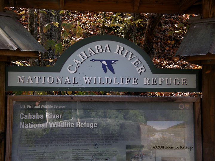
 Entrance to the Cahaba River NWR.
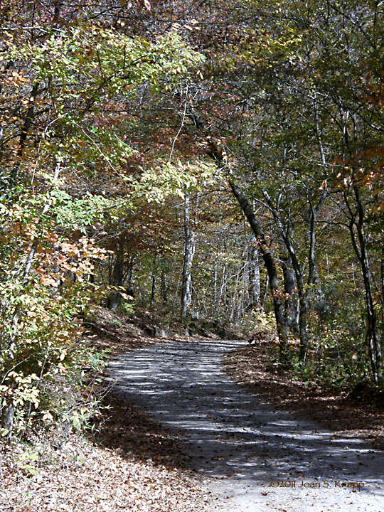
 The road runs along the river bank and is a well-maintained gravel road. In most places it is a one-car-width road with several small pull-outs.
 The river was crystal clear and green. The rocks exposed from the glacial scarring are clearly visible along the river. This shot was taken at the canoe launch.
 Looking north along the river. The top end of the upper lily bed. There’s nothing much to see in the way of lily vegetation at this time of year; the lilies will begin to emerge in mid April.
 Looking across the river. The east bank rises steeply to the ridge above.
 Looking north along the river from the south end of the upper lily bed. The lily bed comes almost to the road at this point.
 The rock ledge - the Pine Island Ford - that marks the south boundary of the upper lily bed.
 Looking to the south. The river has a series of swimming holes. A rope used to swing out over the river hangs from the branch of the tree at the right.
 *****
***** A section of the river south of the upper lily bed is filled with boulders and rock ledges.
The road ends where Caffee Creek empties into the river. There is a maintenance road on the south side of the creek but no public access. Any travel further south would have to be made by canoe or kayak.
 Looking up into Caffee Creek
 Looking out from Caffee Creek into the river.
 Symphyotrichum patens (Late Purple Aster) plants were blooming, as was a single…
 Oenothera fruticosa (Narrowleaf Evening-primrose) plant.
 Looking south towards the lower lily bed. Access to this bed would only be by water.
The Cahaba River NWR provides excellent access to a large bed of Hymenocallis coronaria plants. According to the information board at the NWR entrance indicates that the lilies bloom from mid May to mid June and the brochure available at the information board indicates that it’s easy to wade out to photograph them up close. Sounds like a field trip for next Spring.
Click on an image to view a larger image
Identification resources:
- Encyclopedia of Alabama: Hymenocallis coronaria (Cahaba Lily)
- James Allison: Bibb County, Alabama Wildflowers
Related posts:
- Flint River, Georgia: Woodbury Crossing to Sprewell Bluff State Outdoor Recreation Area
- Flint River, Georgia: Flat Shoals And The Red Oak Creek Covered Bridge
- Landsford Canal State Park, South Carolina: Wildflowers
 The beaver pond below the dam at Fox Lake. Looking southwest over the south end of the dam to the dam containing Fox Lake.
 March 6th. A closer view of the southern end of the beaver dam where there were two short stretches of dam work.
 November 18th. The southern end of the dam – the section shown in the second photograph. The growth of vegetation during the summer has covered the timbers that were laid in March. The beaver appear to have added more mud to the top of the dam. The pond seems to be a little deeper.
 March 6th. The end of this section closest to the road. Some new wood has been added and mud packed onto the top of the dam.
 November 18th. No sign of the timbers we saw in March but fresh mud has been packed into this section.
 March 6th. The western end of this south section, the section away from the road. More new timber.
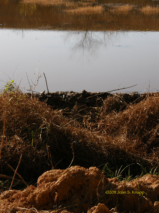 November 18th. Again. No sign of the timbers but more fresh mud has been packed onto the dam in this section.
 March 6th. The north end of the beaver dam. New timber had been added to the dam. Mud had been added but it’s not visible in the photo. Looks like the rangers had been watching this activity and had added a section of pipe – we assumed the beaver didn’t add this - to the dam allow water to drain and discourage the beaver from building the dam higher. Failure of the dam would result in the release of a lot of water against the base of this raised road we were parked on and possibly damaging it.
 November 18th. Looking across the pond at the northern section of the dam. The pond has a Wood Duck nest box, not far from the road and facing away from the road. We’ve never seen any evidence that the box had been used.
 From a distance, they looked different, like Wood Ducks.
 An enlargement of the previous photo. It’s not a good shot but it’s clear they are Wood Ducks (Aix sponsa); two males and a female. They swam around in this area for a few minutes and then they swam…
 back into the grasses and…
 out of sight.