Showing posts with label
Symphyotrichum patens. Late Purple Aster.
Show all posts
Showing posts with label
Symphyotrichum patens. Late Purple Aster.
Show all posts
We’ve been scouting locations to view and, hopefully, photograph Hymenocallis coronaria (Shoals Spider-lily), a lily considered to be a subspecies of Hymenocallis caroliniana (Carolina Spiderlily). Plants grow only in fast-flowing, shallow water currents in shoals on rivers in Alabama, Georgia, and South Carolina. The lily is known variously by the common names: Catawba lily, On Labor Day weekend, we wend to Landsford Canal State Park on the Catawba River in South Carolina. On October 21-22, we scouted locations at Flat Shoals and lower on the Flint River in Georgia. On November 7th, we visited the Cahaba River National Wildlife Refuge in Bibb County, Alabama.
 The Cahaba River NWR is at the south end of the glacial scarring that runs southwest from Tennessee into Alabama. The scarring is clearly visible in this map.
 Our first view of the Cahaba River, upstream, from CR-24.
 We approached the river from the east along Bibb County road, CR-24, also known as Cahaba River Drive. The entrance to the NWR is on the south side of the highway about one-half mile west of the river.
 Entrance to the Cahaba River NWR.
 The road runs along the river bank and is a well-maintained gravel road. In most places it is a one-car-width road with several small pull-outs.
 The river was crystal clear and green. The rocks exposed from the glacial scarring are clearly visible along the river. This shot was taken at the canoe launch.
 Looking north along the river. The top end of the upper lily bed. There’s nothing much to see in the way of lily vegetation at this time of year; the lilies will begin to emerge in mid April.
 Looking across the river. The east bank rises steeply to the ridge above.
 Looking north along the river from the south end of the upper lily bed. The lily bed comes almost to the road at this point.
 The rock ledge - the Pine Island Ford - that marks the south boundary of the upper lily bed.
 Looking to the south. The river has a series of swimming holes. A rope used to swing out over the river hangs from the branch of the tree at the right.
 *****
***** A section of the river south of the upper lily bed is filled with boulders and rock ledges.
The road ends where Caffee Creek empties into the river. There is a maintenance road on the south side of the creek but no public access. Any travel further south would have to be made by canoe or kayak.
 Looking up into Caffee Creek
 Looking out from Caffee Creek into the river.
 Symphyotrichum patens (Late Purple Aster) plants were blooming, as was a single…
 Oenothera fruticosa (Narrowleaf Evening-primrose) plant.
 Looking south towards the lower lily bed. Access to this bed would only be by water.
The Cahaba River NWR provides excellent access to a large bed of Hymenocallis coronaria plants. According to the information board at the NWR entrance indicates that the lilies bloom from mid May to mid June and the brochure available at the information board indicates that it’s easy to wade out to photograph them up close. Sounds like a field trip for next Spring.
Click on an image to view a larger image
Identification resources:
- Encyclopedia of Alabama: Hymenocallis coronaria (Cahaba Lily)
- James Allison: Bibb County, Alabama Wildflowers
Related posts:
- Flint River, Georgia: Woodbury Crossing to Sprewell Bluff State Outdoor Recreation Area
- Flint River, Georgia: Flat Shoals And The Red Oak Creek Covered Bridge
- Landsford Canal State Park, South Carolina: Wildflowers
Continued from here.
On Labor Day weekend, we went over to Landsford Canal State Park in South Carolina to scout locations to view and, hopefully, photograph Hymenocallis coronaria, a lily considered to be a subspecies of Hymenocallis caroliniana (Carolina Spiderlily). Plants grow only in fast-flowing, shallow water currents in shoals on rivers in Alabama, Georgia, and South Carolina. On October 21-22, we went to scout locations on the Flint River for access to photograph the lilies.
To view the section of the Flint River we covered over the two days, you can trace the river from here at Flat Shoals downstream to the Flint River crossing near Woodbury, and then south to Sprewell Bluff State Outdoor Recreation Area. On Friday, we started at the Flat Shoals crossing of the Flint River and stumbled on the Red Oak Creek Covered Bridge, a completely serendipitous encounter. On Saturday we covered the area from the ‘Woodbury crossing over the Flint River south to Sprewell Bluff State Outdoor Recreation Area (ORA) – starts here.
 The put-in point to float the Flint River though the shoals to view stands of Hymenocallis coronaria is at this crossing of GA-18 over the Flint River.
 The view downstream from the put-in point at the GA-18 crossing of the Flint River to float down the river through the rapids with their stands of Hymenocallis coronaria. You can’t see very far but the river twists and turns between here and the take-out point at Sprewell Bluff State ORA.
We drove south on the eastern side of the river along Dripping Rock Rd, Thundering Springs Rd, Pleasant Valley Rd, Turkey Creek Rd, Fork Dr, Pasley Shoals Rd, and Sprewell Bluff Rd into the State ORA.
 Chrysopsis mariana (Maryland Goldenaster). We saw a lot of these along the road, and just a few...
 Liatris sp. flowers
 Looking west-northwest along the Flint River from a pull-out on Sprewell Bluff Rd. This was the only place to view the river before reaching the ORA.
 A closer view from this point.
 At Sprewell Bluff State Outdoor Recreation Area.
 Looking north along the river from the picnic area. This area is a day use-only area with several hiking trails.
 Fall color was just starting to develop.
 Looking directly across the river to bluffs on the west side..
 Looking south along the river.
We drove back north along roads on the west side of the river and saw...
 this flower again – growing in full sun this time. Previously I’d seen it in the Piedmont NWR, growing in the shade. In the sun, the plant grows in a compact shape, about 12 – 18 inches tall. My best guess is that this may be Stachys floridana (Florida Betony).
 We also saw a lot of Symphyotrichum patens (Late Purple Aster) in bloom. This bloom is a noticeably darker purple bloom than most asters.
This section of the Flint River has very few access points that would allow easy viewing of Hymenocallis coronaria. The Flat Shoals is the only area that can been seen from the road. A float trip down the river is the only way to really get close to these lilies in this area.
Click on an image to view a larger image
Identification resources:
- Southeastern Flora
Related posts:
- Flint River, Georgia: Flat Shoals And The Red Oak Creek Covered Bridge
- Landsford Canal State Park, South Carolina: Wildflowers
 The Cahaba River NWR is at the south end of the glacial scarring that runs southwest from Tennessee into Alabama. The scarring is clearly visible in this map.
 Our first view of the Cahaba River, upstream, from CR-24.
 We approached the river from the east along Bibb County road, CR-24, also known as Cahaba River Drive. The entrance to the NWR is on the south side of the highway about one-half mile west of the river.
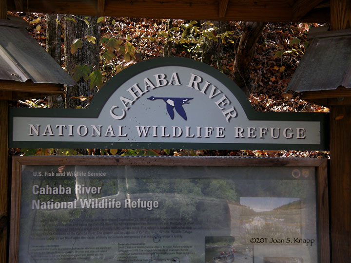 Entrance to the Cahaba River NWR.
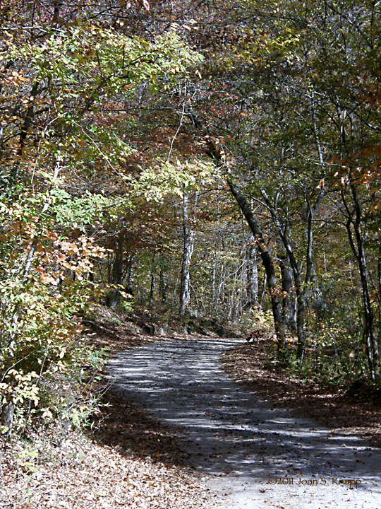 The road runs along the river bank and is a well-maintained gravel road. In most places it is a one-car-width road with several small pull-outs.
 The river was crystal clear and green. The rocks exposed from the glacial scarring are clearly visible along the river. This shot was taken at the canoe launch.
 Looking north along the river. The top end of the upper lily bed. There’s nothing much to see in the way of lily vegetation at this time of year; the lilies will begin to emerge in mid April.
 Looking across the river. The east bank rises steeply to the ridge above.
 Looking north along the river from the south end of the upper lily bed. The lily bed comes almost to the road at this point.
 The rock ledge - the Pine Island Ford - that marks the south boundary of the upper lily bed.
 Looking to the south. The river has a series of swimming holes. A rope used to swing out over the river hangs from the branch of the tree at the right.
 *****
***** A section of the river south of the upper lily bed is filled with boulders and rock ledges.
 Looking up into Caffee Creek
 Looking out from Caffee Creek into the river.
 Symphyotrichum patens (Late Purple Aster) plants were blooming, as was a single…
 Oenothera fruticosa (Narrowleaf Evening-primrose) plant.
 Looking south towards the lower lily bed. Access to this bed would only be by water.


