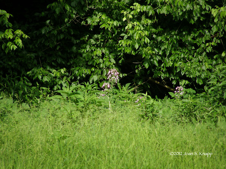
Last year, we spotted a Pink Queen (Cleome hassleriana) plant in bloom across Fishing Creek from a trail off the end of Forest Service road FS1245B. W managed to get a reasonable photograph but there was no way that we could get across to get close-up photos. Incidentally, this was probably the final straw contributing to our decision to get a small, shallow draft boat to allow us to get access to remote areas from the water. Anyway. We were making our way up the Oconee River when we spotted plants that were starting to bloom. A couple were at a spot where we could step out of the boat to get closer views.
 From a distance. We spotted plants on the shore but couldn't reach them.
 A closer view.
 The plants we could reach.
 In profile. Before going ashore. We still didn’t know if the river bottom was solid or if we’d sink knee-deep in mud as is often the case along these rivers.
 It has a compound leaf.
 A flower head with no flowers open
 *****
***** Flower heads with a couple of opened flowers.
 *****
***** Individual opened flowers. I focused on the petals but it is possible to make out the stamen and stigma in each of the photos.
Cleome hassleriana (Pink Queen) is a native of South America, from Argentina to Brazil. In the United States, it’s found in states east of a line from Wisconsin, Ohio, Kansas, Oklahoma and Texas with the exception of the New England state. It may also been found in Ontario, Canada.
It’s an unusual find. According to the USDA Plant Database, this plant has been documented in only three counties in Georgia - White, Harris, and Lowndes counties. It hasn’t been officially documented in Greene County The most probable explanation for finding it here was that it was planted in a garden upstream - the Oconee River flows through Athens, Georgia, and seeds floated downstream and took root on this shore line. Although it’s an intriguing flower, I hate to see non-native plants take a hold beyond the domestic garden.
Click on an image to view a larger imageIdentification resources:
- Southeastern Flora: Pink Queen (Cleome hassleriana)
Distribution:
- United States Department of Agriculture Plants Database: Cleome hassleriana (Pink Queen)
- University of North Carolina Herbarium: Cleome hassleriana
Related post:
- A Lonely Traveler: Pink Queen (Cleome hassleriana)
March 17th. 2012. Last year, in June, we visited the Scull Shoals Experimental Forest in the Oconee National Forest near a swamp on Sandy Creek and found a number of interesting plants. Among them was a trillium that had developed seeds. We decided that we wanted to revisit this area earlier in the Spring to look for trilliums in bloom. We’d checked the location a couple of times but didn’t find any. Last Saturday, however, was different.
We drove along the road that parallels a swamp along the creek. We weren’t overly hopeful but then I spotted one on the bank above the road. And it was blooming!
 Trillium cuneatum (Little Sweet Betsy). I clambered up the slope – no mean feat – over a carpet of loose leave and managed to settle next the plant without slipping down the slope again. (It’s been known to happen)
 A closer view of the leaves and bloom. This is a relatively young plant, and…
 of the flower. This flower is fully opened. The bracts are folded back against the leaves and the petals have opened as far as they will. The stamen are visible between the petals. These maroon/gold stamen are characteristic of this species.
While I was up on the slope, W was looking around on the other side of the road. He spotted..
 this cluster of older plants. They blended into their background so well that he had to point them out to me. These plants were…
 still in the budding stage.
 A close view of the bud.
We wandered along the road to where we saw the trillium last year. Behind a tree not far from the road, W found this…
 cluster of plants in various stages of blooming. This was the largest stand of trilliums that we found here.
 This bud is just opening
 The bracts are partially folded back
 The bracts have folded back fully and the petals have opened
 A close view of the maroon/gold stamen that are characteristic of this species
We were excited to find these plants. We found many more on both sides of the road in this small, shaded area where a small stream empties into the swamp. This find was well worth the wait!
Trillium cuneatum is known by the common names Little Sweet Betsy, Purple Toadshade, Whippoorwill Flower, and Large Toadshade. It is stalked, had mottled leaves and erect flowers that are purple to brown. The anthers and stamen are a characteristic maroon and gold. Trillums are found in Asia and North America. This species is found in the eastern United States from Pennsylvania and Illinois south and southeast to Georgia, Alabama and Mississippi.
Click on an image to view a larger image
Identification resources:
- Southeastern Flora: Trillium cuneatum (Little Sweet Betsy)
- Native and Naturalized Plants of the Carolinas and Georgia: Trillium cuneatum (Little Sweet Betsy, Purple Toadshade, Whippoorwill Flower)
Distribution:
- University of North Carolina Herbarium: Trillium cuneatum
- USDA Plants Database: Trillium cuneatum (Little Sweet Betsy)
Related Posts:
- Plants We Find In The Woods At Dusk
- 2010: Year Of The Wildflower – Wildflower Index
We drove down to the Redlands WMA in the Oconee National Forest at Fishing Creek/Oconee River. From the turnaround at the end of Forest Service road FS1245B,
 it was a short walk down to Fishing Creek at a point where the creek is wide.
 We spotted an unusual flower on an island where Fishing Creek empties into the Oconee River. It’s in the center of the photo, at the edge of the water
 A closer view. Still in the center of the photo
 W was able to get a better photo than I could. We’ve identified it as a Pink Queen (Cleome hassleriana). Seed pods are clearly visible in this photograph.
Cleome hassleriana (Pink Queen) is a native of South America, from Argentina to Brazil. In the United States, it’s found in states east of a line from Wisconsin, Ohio, Kansas, Oklahoma and Texas with the exception of the New England state. It may also been found in Ontario, Canada.
It’s an unusual find. According to the USDA Plant Database, this plant has been documented in only three counties in Georgia - White, Harris, and Lowndes counties. It hasn’t been formally documented in Greene County The most probable explanation for finding it here was that it was planted in a garden upstream along Fishing Creek and seeds floated downstream and took root on this shore line.
Click on an image to view a larger image
Distribution:
- United States Department of Agriculture Plants Database: Cleome hassleriana (Pink Queen)
- University of North Carolina Herbarium: Cleome hassleriana
Identification resources:
- Southeastern Flora: Pink Queen (Cleome hassleriana)
Related post:
- 2010: Year Of The Wildflower – Wildflower Index
We’d had several cloudy, gray days during the ‘big snow.’ Cabin fever was setting in. Then the sun broke through and we had to get out. It was cold but the sun made up for it.
 We drove down to Jasper County where we criss-crossed the Oconee National Forest. This photo was taken as we crossed a tributary of the Little River. It looks warmer than it was but we enjoyed the sun.
Click on the image to view a larger image
When we got back to GA-15, we turned south and drove to Cold Springs Rd, approximately 19 miles south of Watkinsville.
 We turned west on Cold Springs Rd. This barn – I have a thing for barns – is the first landmark of interest…
 and is part of this property which grazes cattle. In the distance, hay is stored at the edge of the woods in readiness for winter.
We took the first road on the right (FS 1245) into the Redlands Wildlife Management Area. We explored two roads through the woods, FS 1245 and FS 1245a. These are gravel roads that wind through the pine woods.
 The south branch (FS 1245) wound down through the woods to a bend in the Oconee River. It’s marked on the Redlands WMA map as a canoe launch. There was little room to park – no formal parking area; just spots among the trees - and the area was being used by fishermen to launch boats. We could only see a small section of the river, but the map indicates that there could be some interesting side pools off the river just north of this point.
 The north branch of the road (FS 1245a) ended in a turnaround where the road became impassable. It was a pity that the road ended here. It looks like it’s just a short distance down to the river. Tall Goldenrod plants were blooming at the edge of the turnaround; there must have been easily 50 Pearl Crescents feeding on them.
Interestingly, just before we reached the turnaround, a section of the road was flooded and we had to drive slowly. Just at the end of the flooded section, I spotted a 4-5 foot tall Strawberry Bush (Euonymus americanus) with many ripe fruit. This is the only 'wild' Strawberry Bush I've seen apart from those at Fort Yargo State Park. This bush was much larger than those at Fort Yargo SP.
We returned to Cold Springs Rd and completed the loop around the road through an area of farms and the Oconee National Forest until the road returned to the Greensboro Hwy. We drove back north to Fishing Creek. Some years ago, we had recorded Bird-voiced (Hyla avivoca), Cope’s Gray (Hyla crysoscelis) and hybrid Bird-voiced/Cope’s Gray treefrogs where GA-15 crossed Fishing Creek. It is impossible to see the creek at this site because of the trees that shade the creek. To see the creek, we turned east onto Nichols Rd (about 15 miles south of Watkinsville) and then south and followed Callaway Rd to Fishing Creek.
 Looking east along Fishing Creek..
 And at the swampy area immediately to the north of the creek.
 I could see several schools of fingerlings in the creek below the bridge.
 We continued along Callaway Rd and turned west on Boswell Rd by woods and grassy fields to return to the Greensboro Hwy, and then back north to Watkinsville.
Click on an image to view a larger image
Map source:
Georgia Outdoors: Redlands WMA
Related posts:
- Field Trip: Oconee-Greene County. Part 1, Elders Mill Covered Bridge
- Field Trip: Oconee-Greene County, Part 2. Sand Pit – Ward Rd
 An individual plant. The plants grow about 18 inches tall in our area. They seems to bloom more profusely in the Fall than in the Spring.
 A closer view of the flowers. They are small but quite striking. It’s worth taking a closer look at them. The flowers are about 1/4 inches in diameter but stand out because of their simple. ‘clean’ structure.
 A fertilized flower. The ovary is just starting to swell
 A closer view. The ovary is developing above the petal-like bracts. It’s visible as a swollen green structure just below the stigmas.
 A small, developing, stalked seed pod.
 *****
***** The seed pods are swelling. When ripe the seed pods explode to catapult the seeds into the surrounding area.