When we got back to GA-15, we turned south and drove to Cold Springs Rd, approximately 19 miles south of Watkinsville.
 We turned west on Cold Springs Rd. This barn – I have a thing for barns – is the first landmark of interest…
 and is part of this property which grazes cattle. In the distance, hay is stored at the edge of the woods in readiness for winter.
We took the first road on the right (FS 1245) into the Redlands Wildlife Management Area. We explored two roads through the woods, FS 1245 and FS 1245a. These are gravel roads that wind through the pine woods.
 The south branch (FS 1245) wound down through the woods to a bend in the Oconee River. It’s marked on the Redlands WMA map as a canoe launch. There was little room to park – no formal parking area; just spots among the trees - and the area was being used by fishermen to launch boats. We could only see a small section of the river, but the map indicates that there could be some interesting side pools off the river just north of this point.
 The north branch of the road (FS 1245a) ended in a turnaround where the road became impassable. It was a pity that the road ended here. It looks like it’s just a short distance down to the river. Tall Goldenrod plants were blooming at the edge of the turnaround; there must have been easily 50 Pearl Crescents feeding on them.
Interestingly, just before we reached the turnaround, a section of the road was flooded and we had to drive slowly. Just at the end of the flooded section, I spotted a 4-5 foot tall Strawberry Bush (Euonymus americanus) with many ripe fruit. This is the only 'wild' Strawberry Bush I've seen apart from those at Fort Yargo State Park. This bush was much larger than those at Fort Yargo SP.
We returned to Cold Springs Rd and completed the loop around the road through an area of farms and the Oconee National Forest until the road returned to the Greensboro Hwy. We drove back north to Fishing Creek. Some years ago, we had recorded Bird-voiced (Hyla avivoca), Cope’s Gray (Hyla crysoscelis) and hybrid Bird-voiced/Cope’s Gray treefrogs where GA-15 crossed Fishing Creek. It is impossible to see the creek at this site because of the trees that shade the creek. To see the creek, we turned east onto Nichols Rd (about 15 miles south of Watkinsville) and then south and followed Callaway Rd to Fishing Creek.
 Looking east along Fishing Creek..
 And at the swampy area immediately to the north of the creek.
 I could see several schools of fingerlings in the creek below the bridge.
 We continued along Callaway Rd and turned west on Boswell Rd by woods and grassy fields to return to the Greensboro Hwy, and then back north to Watkinsville.
Click on an image to view a larger image
Map source:
Georgia Outdoors: Redlands WMA
Related posts:
- Field Trip: Oconee-Greene County. Part 1, Elders Mill Covered Bridge
- Field Trip: Oconee-Greene County, Part 2. Sand Pit – Ward Rd
In early October there were still some butterflies and wildflowers around about but the season was rapidly winding down. So this was a perfect time to start scouting locations to find new and such year. Roadsides and fields that are not mowed are the best places to find wildflowers. Most roadsides in Georgia are mowed at least once, if not twice, each year. Although mowing reduces the amount of flammable material that might fuel a brush fire, wildflowers – particularly annuals - may not go to seed before they are mowed and are eradicated within a few years. So we look for rural, gravel roads that are not mowed often if at all. State parks and clear-cut areas in national forests, wildlife management areas or national wildlife refuges are also great places for wildflowers and butterflies. So it’s a matter of driving roads to find areas to visit next year.
 Our first trip was through part of Oconee and Greene counties. We started in Watkinsville, the county seat of Oconee County and drove south on Greensboro Hwy (GA-15). We stopped at the Elder Mill Covered Bridge before we continued down into Greene County to circle through a section of the Redlands Wildlife Management area and the Oconee National Forest before circling back via Fishing Creek. Elder Mill Covered Bridge (A) about four miles south of Watkinsville and is one of 15 covered bridges in Georgia.
 The historic marker that gives a concise history of the bridge.
 The approach to the bridge, both from east and west, is down a steep, gravel road. There are a few parking places on the west side of the bridge. The bridge is in excellent shape and it’s worth stopping for a closer look.
 A view of the bridge from the southwest side. There are no ‘windows’ in this bridge.
 The timbers are held with wooden dowels.
 Mud wasps have built nests along the upper supports. This is a perfect spot out of the weather. It's interesting that there are at least three different colored clays in these nests.
 This is not a prime area for wildflowers. However there are some and this Green Anole (Anolis carolinsis) was hunting insects in the brush.
Click on an image to view a larger image
Resources:
- Georgia Outdoors: Map, Redlands WMA
- Georgia’s Covered Bridges:
--- Interactive Map
--- List and directions
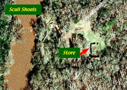
 The arched bridge and power plant are located to the south and slightly west of the store.
  On our way, we stumbled over this beautiful colony of bracket fungi.
 The area where the arched bridge and power plant were located was somewhat overgrown and it would have been easy to give up the search. We got a glimpse of stonework supports and decided to try to get through to get a better look.
 We rounded a chain-link fence and were rewarded with a glimpse of the arched bridge. Certainly worth a closer look. It’s a pity that the bridge is enclosed by a fence but this is probably necessary to preserve it since it is vulnerable.
 A view of the bridge. We have dropped down into a ditch which was the raceway to bring water from the Oconee River to the power plant. We walked carefully in the leaves. It was still warm enough for snakes to be about and Timber/Canebreak Rattlesnakes (Crotalus horridus) could 'hide' in plain sight in these leaves.
 A closer view of the brickwork on the arch of the bridge.
 We climbed up out of the raceway and were treated to an overview of the power plant foundations. A wall to the right and supports for the floor.
  A closer view of the wall to the right of the previous photo.
 Looking straight at the wall on the right. This view shows the excellent stone masonry.
  *****
***** A closer view of a couple of the center supports.
 This arched structure is partially buried in the ground. I don’t know what it is but it's another excellent example of decorative stonework.