 The site is visible on Google maps. (The parking area is in the upper right of the map).
  The buildings at Sculls Shoals are in ruins. Anything made of wood is gone. Foundations and the store - the only structures made of stone or brick – are all that remain. Since the town is in ruins and very little stands above ground, we found ourselves using the photograph we took of the diagram on the visitors information board as a map as we made our way around.
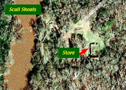
  Looking towards the store from the parking lot.
 The area to the right of the store, looking from the parking lot; the superintendant’s and workers houses were in this area as was the blacksmiths shop.
 Looking at the front (north side) of the store.
 The east wall of the store is mostly gone. Only a small section at the south end still stands.
 The south (rear) wall of the store – photographed from the east side - is almost completely intact.
 Clearly it was expected that this settlement would be permanent judging by the decorative brickwork at the top of the wall.
 A closer view of the decorative brickwork.
 The rear wall of the building photographed from the west side.
 The west wall of the store.
 A closer view of the west wall, photographed from the southwest side.
 A closer view of a doorway on the west wall. The doorway was originally constructed to be fitted with double doors. Based on historic photographs, the inner layers of bricks were added and a single door fitted to the space.
 The segmental arch above the door.
From here we set off to explore the remains of the arched brick bridge over the raceway to the power plant and the power plant foundations.
Click on an image to view a larger image
Resources:
- Trip map (Google): Scull Shoals
- Location map (Google): Scull Shoals site
- Friends of Scull Shoals: A Brief History of Scull Shoals Mill Village
- Urban Baboon: Scull Shoals
Related posts:
- Field Trip: Scull Shoals. Part 1, Oconee River – Sandy Creek
- Field Trip: Oconee-Greene County. Part 1, Elders Mill Covered Bridge
- Field Trip: Oconee-Greene County. Part 2, Sand Pit – Ward Rd
- Field Trip: Oconee-Greene County. Part 3. Oconee National Forest & Fishing Creek
No comments:
Post a Comment