Thursday, September 30, 2010

Juniper Leaf (Polypremum procumbens)

Polypremum procumbens is known by the common names Juniper Leaf, Polypremum, Rustweed, and Juniperleaf. It’s one of those plants you might not notice unless you look closely; it’s easy to miss. It has tiny white flowers that are about 1/4 inch in diameter. At our place it grows in the grass in the field. The rich green of it’s foliage contrasts with the grey green on the field grass. It starts to bloom in mid June.

A plant growing in the grass. It’s more noticeable if it’s flowering.

A closer view of a flower and leaves.

Close view of a flower.

A flower and leaves in profile.

Polypremum procumbens
(Juniper Leaf) is native to the United States and grows from New York state to Texas.

Click on an image to view a larger image


Distribution Map:

- United States Department of Agriculture Plants Database: Polypremum procumbens (Juniper Leaf)

- University of North Carolina Herbarium: Polypremum procumbens


Identification resources:

- Southeastern Flora: Juniper Leaf (Polypremum procumbens)

- Missouri Plants: Polypremum procumbens


Related posts:

- 2010: Year Of The Wildflower – Wildflower Index

Wednesday, September 29, 2010

Spotted St. Johnswort (Hypericum punctatum)

Hypericum punctatum is known by the common name Spotted St. Johnswort. This is one of several Hypericum species that grows in this area. I’ve seen it along the trail in open woodlands south of the Fishing Area (segment 13). It began blooming in mid June.

The plant in bloom.

Plants grow about 24-30 inches high in this area.

Blooms beginning to open. The spots on buds, flowers, and leaves are quite obvious.

A close up of the bloom, straight on.

The spots are very obvious on the back side of this bloom.

The bloom in profile.

The leaves are simple and opposite.

Spots are also visible on the stem and leaves.

Hypericum punctatum (Spotted St. Johnswort) is native to the eastern United States and Canada.

Click on an image to view a larger image


Distribution Map:
- United States Department of Agriculture Plants Database: Hypericum punctatum (Spotted St. Johnswort)
- University of North Carolina Herbarium: Hypericum punctatum

Identification resources:
- Southeastern Flora: Spotted St. Johnswort (Hypericum punctatum)
- Natural and Naturalized Plants of the Carolinas and Georgia: Hypericum punctatum (Spotted St. Johnswort)
- Missouri Plants: Hypericum punctatum

Related posts:

- 2010: Year Of The Wildflower – Wildflower Index

- Clasping St. Johnswort (Hypericum gymnanthum)

Tuesday, September 28, 2010

Hackberry Emperor (Asterocampa celtis)

It was late afternoon. We’d gone to Charlie Elliott Wildlife Center in Jasper County to look for wildflowers and dragonflies. Our last stop was at Whitetail Lake. We walked along the dam where we found clusters of Sleepy Orange butterflies (Abaeis nicippe) sipping moisture to get salts from the mud.

We headed back to the car after the sun had dropped behind the trees. The light was quite poor. But there on some dung was a Hackberry Emperor (Asterocampa celtis) also sipping salts in the moisture. I used flash to take these photos. This is the first Hackberry Emperor I’d seen; he's a male. The Hackberry Emperor is not common in Georgia compared with other areas in the United States.


He spent most of the time with folded wings.

Occasionally he would open its wings.

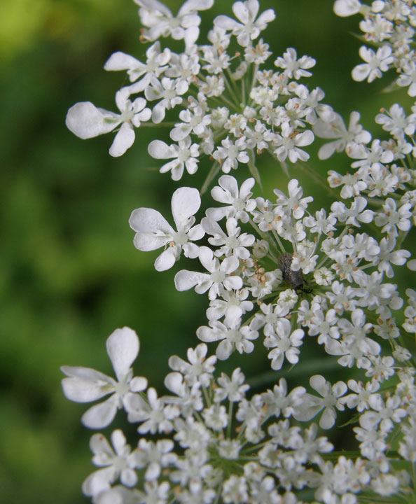
We went back to ‘Charlie Elliott’ a couple of days later to photograph wildflowers. We stopped along the road not too far from Whitetail Lake to photograph some thistles.


This butterfly, also male, decided that Ws t-shirt was ‘taste of the day’ and proceeded to ‘collect’ salts. He was persistent and, If spooked, he would fly around for a few seconds and return again. He did this for 10 to 15 minutes.
Click on an image to view a larger image


Identification resources:

- Westcentral Georgia Butterflies by Michael Beohm: Hackberry Emperor (Asterocampa celtis)

- BugGuide: Hackberry Emperor (Asterocampa celtis)

-- Male
: [Wings open] [Wings folded]
-- Female
: [Wings open] [Wings folded]
- Butterflies and Moths of North America: Hackberry Emperor (Asterocampa celtis)

Monday, September 27, 2010

Twining Snoutbean (Rhynchosia tomentosa)

Rhynchosia tomentosa is known by the common names Twining Snoutbean. We found it growing on an embankment by a gravel road in Wilkes County not far from where we found the Asclepias viridiflora plant. At Fort Yargo State Park, I’ve only found it in a small area east of the swimming beach (segment 14). It bloomed in mid June.

A plant growing on a roadside embankment in Wilkes County.

A plant almost hidden by other plants on the roadside embankment in Wilkes County.

A plant growing on an embankment above the lake at Fort Yargo State Park (segment 14).

Close up of the flower head.

Developing seed pods.

Rhynchosia tomentosa
(Twining Snoutbean) is native to the southeastern United States.

Click on an image to view a larger image


Distribution Map:

- United States Department of Agriculture Plants Database: Rhynchosia tomentosa (Twining Snoutbean)

- University of North Carolina Herbarium: Rhynchosia tomentosa


Identification resources:

- Natural and Naturalized Plants of the Carolinas and Georgia: Rhynchosia tomentosa (Twining Snoutbean)

- Alabama Plants: Rhynchosia tomentosa


Related posts:

- 2010: Year Of The Wildflower – Wildflower Index

Sunday, September 26, 2010

Creeping Lespedeza (Lespedeza repens)

Lespedeza repens is known by the common names Creeping Lespedeza, Creeping Bush-clover, or Smooth Trailing Lespedeza. At Fort Yargo State Park it grows in several places including along the trail south of the Fishing Area (segment 13). We found it in Wilkes County near where we found the Asclepias viridiflora and by the roadside across from out house. It grows as runners in an ‘open’ pattern with short spikes of flowers. It blooms starting in June and can be found blooming for several months.

A plant growing at the road side in Wilkes County.

Close up of the runner.

A close up of a flower spike in Wilkes County.

A close up of a flower spike at Fort Yargo State Park (segment 13).

Back view, with sepals, of a flower spike at Fort Yargo State Park.

A flowering plant in the rain along the lake shore at Fort Yargo State Park. (segment 9).

A plant that has rooted in a vertical section of the lake shore at Fort Yargo State Park (segment 4).

A close up of the same plant.

Lespedeza repens
(Creeping Lespedeza) is native to the eastern United States.

Click on an image to view a larger image


Distribution Map:

- United States Department of Agriculture Plants Database: Lespedeza repens (Creeping Lespedeza)
-
University of North Carolina Herbarium: Lespedeza repens

Identification resources:

- Southeastern Flora: Creeping Lespedeza (Lespedeza repens)

- Natural and Naturalized Plants of the Carolinas and Georgia: Lespedeza repens (Creeping Bush-clover, Creeping Lespedeza, Smooth Trailing Lespedeza)


Related posts:

- 2010: Year Of The Wildflower – Wildflower Index

Saturday, September 25, 2010

First Fall Row

Although yesterday was the second full day of fall, a temperature high of 90+F was predicted. When the weather’s hot like this, it’s best go get out early before it gets too hot. Even at 8:00 in the morning at 70F, the sun had a good bite to it. But I can get back to the boat launch before it gets too hot.

The post ‘Harvest’ moon is still high in the sky as I head to the lake.

And the fog still clings to the ground.

The sun is already up and the light is blinding when I set out but it’s a pretty sight looking east from the boat launch. The water is still calm this early in the morning. There’s a light early morning breeze but not enough to disturb the water. The only ripples are from the oars moving the boat through the water.

The sun is lighting up the picnic area (segment 15).

From the neck (between segments 10-12) looking south towards the dam. The large trees silhouetted on the right are on the point at the Fishing Area (segments 12-13).

Until last Fall (2009), a pedestrian bridge spanned the water between the north end of the Wil-A-Way Recreation Center (segment 10) and the Nature Center. It’s just visible in the satellite image. The bridge decking was removed last and the pilings and deck supports were removed during the Winter. Now I can row into this area (segment 10a). This is a new experience.

The new route. This adds more distance to the previous route which ran just along the west side of the bridge. Click to view in Google Maps.

The observation deck on the edge of the lake which is accessed from the Bird Berry Trail. At the moment the upper end of the lake is blocked by rafts of Alligator Weed.

Looking directly west from segment 10a to the point (segment 10-11) and the bridge crossing the road from the park office to the picnic areas. The Old Fort is in the open area at the far left.

View from the neck (segment 10-12) looking back to the Nature Center and dock. The dock on the right is attached to the Wil-A-Way Recreation Center.
Click on an image to view a larger image

Related posts:

- Marburg Creek Reservoir: Fort Yargo State Park

- Loose with a Camera…

Friday, September 24, 2010

Queen Anne's Lace (Daucus carota)

Daucus carota is known by the common names Queen Anne's Lace, Wild Carrot, or Bird's Nest. It grows along roadsides. In Fort Yargo State Park, it grows at the west end of the dam (segment 4/5). It began to bloom in mid June.

The flower head is just beginning to form.

A little further along…

And further still…

And further still….

The distinct florets are developing.

The characteristic flower head is taking shape.

In full bloom

A close up of the florets

*****
Occasionally, the florets are pinkish

Characteristic leaves.

Daucus carota
(Queen Anne's Lace) is native to Europe. It grows in all states in the United States and most provinces in Canada.

Click on an image to view a larger image


Distribution Map:

- United States Department of Agriculture Plants Database: Daucus carota (Queen Anne's Lace)

- University of North Carolina Herbarium: Daucus carota


Identification resources:

- Southeastern Flora: Queen Anne's Lace (Daucus carota)

- Natural and Naturalized Plants of the Carolinas and Georgia: Daucus carota (Queen Anne's Lace, Wild Carrot, Bird's Nest)

- Missouri Plants: Daucus carota


Related posts:

- 2010: Year Of The Wildflower – Wildflower Index

Thursday, September 23, 2010

Early Fall Feast

I’ve never really kept track of when the walnuts on the Black Walnuts (Juglans nigra) are ripe.

Usually I see this - a pile of shells long after the nuts have been eaten. The walnut shells have cracked fairly cleanly along the seam.

But a week or so ago, noticed a few nuts still encased in their husks on the ground along the Rock Garden Trail (segment 12). Notice that it’s sitting among developing fruit of the Strawberry Bush (Euonymus americanus)?

Then I came upon a few of these along the upper trail back to the parking lot. Starting at one end, ‘someone’ had nibbled most of the husk off the nut and through the end of the nut itself.

An ‘end-on’ view showing the neat cross-section of the nut. There were quite a few of these in a couple of spots along the trail.

One of the suspects. This squirrel was hunting on the ground early that morning.

I’ve never seen anything like this before. Is this an unusual approach to opening walnuts in the wild?

Click on an image to view a larger image


Related posts:

- Dinner for One