March 2nd. (Continued from…) It’s the time of year when
there seem to be more rainy days than not. I wanted to fit something in to a
‘dry’ day and decided to check out Hard Labor Creek State Park. I’ve driven
through the park many times and rowed Lake Rutledge on several occasions but
I’ve never hiked in the park.
I wanted something different from the short nature trails in
the center of the park so I decided to hike one of the equestrian trails. I had
a copy of the Gerogia State Parks Hard Labor Creek State Park Trail Map and my
handheld GPS to trace my trail.
My first choice was to hike part of the Lake Rutledge Trail
which didn’t seem to have the same elevation gains that I anticipated would be
involved in the Lake Brantley Trail, particularly since I was braking in new
hiking boots. As it happened, I abandoned the Lake Rutledge Trail and decided
to hike at least part of the Lake Brantley Trail.

The route I took. This includes the first section, and
return, along the Lake Rutledge Trail.


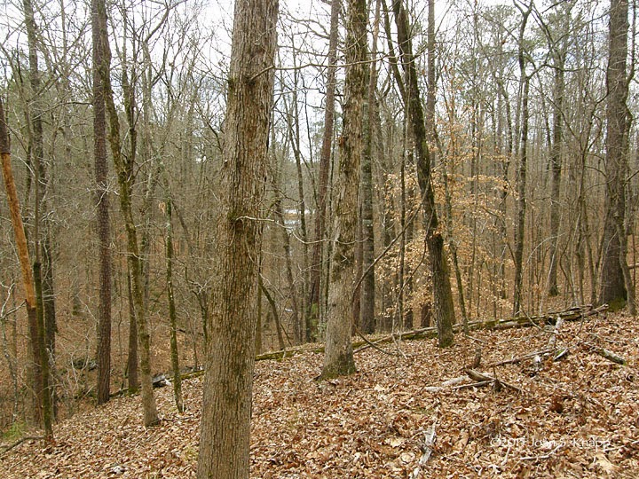
The trail was fairly level at the beginning and passed an ephemeral pool not
far from the road.
I
could feel the breeze from the west and expected that these woods, which would
receive the breezes coming from westerly directions, would be drier than the
woods on the east side of the road which were in the lee of the ridge down
which Fairplay Road ran.


The
trail switched back up the gully to cross the creek...


Looking
up the gully. The creek probably dries up in summer but there’s sufficient
moisture to support the Christmas Ferns (Polystichum acrostichoides) that had
colonized the embankments along the bottom of the gully.

What
looked like a recent sign that directed trail users to turn back south. It did
look as if the trail went straight uphill. At this point I became a little
concerned that the trail had been redirected and was not going to lead to the gray
trail. I certainly didn’t want to be forced to hike the complete trail on this
occasion. But I didn’t want to turn back and climb a steep trail if a more
gentle trail back up the hill lay ahead.
As
I headed south, I caught my first glimpse of Lake Brantley through the trees.

The
trail descended much more gently to a short distance from the water. I could
have walked over to the waters edge without any difficulty but there weren’t
any wildflowers and I was a little more concerned with where I was on the trail
to do too much time-consuming sightseeing.

Some
lichen, probably a Parmotrema sp., with fruiting bodies. Not quite as pretty as
the specimen I found at the Piedmont NWR recently,
but laden with fruiting bodies.

The
trail followed the water and I expected that, according to where I thought I
was on the park map, the trail would continue straight ahead to the place where
I’d find the sign for the Gray Trail to take me over to the Green Trail that
would return me to Fairplay Road.

The
trail was marked by green paint on the trunks of trees.


Then
the trail began to climb more steeply.

A
creek ran to the left side of the trail. I came to a ford on the strean. A
large sign on the far side of the creek indicated that the Lake Brantley Trail
went to the left. I forded the creek but became nervous that I was starting on
the beginning of the 8.8-mile trail option, something that I didn’t want to do
on this occasion. From across the creek, I could see a wide path up the hill.

I
crossed back over the creek and walked over to investigate. In the shade to the
right of the trail, was a sign that indicated that the wide path going up the
hill would return me to the stables where I had started from. (The actual sign
was in deep shade; this sign was at Fairplay Road.).

Looking
back down the trail. As I walked up the hill, I could see the tracks of very
large tires, similar to those on tractor-like vehicles, indicating that this
was an access road to the creek. At the top of the hill, it was clear that this
was a road. I followed it as it went southeast until I found a green trail sign
pointing east. After following the road for a short distance, it joined another
road which took me east and back to Fairplay Road. I had already decided that I
would talk back to my car on the road rather than the trail east of Fairplay
Road.

When
I got home I decided to compare the trail on the park map with the trail trace
on my GPS to figure out where I actually hiked compared with the trail marked
on the park map. It appears that I had reached the short-cut Gray Loop marked
on the park map although I didn’t find the #16 or #18 markers on the park map
or any reference to the ‘Gray Loop.’
It’s
important to note that, due to scale issues, trails on maps like the park map
may not show turns in trails with the detail with which they actually occur. It’s
also important to note that the trail was obvious when I was following it -
with green markers, either posts or green paint marks on tree trunks – and
there was very little chance of straying from the trail. In some respects, I
had complicated the issue by having a GPS which traced my tracks and showed the
trail in more detail than the park map was able to. Although I would note that I
have used a GPS to show me where I am on trails to compare with more-detailed
trail maps with considerable success.
In
this instance, it would have helped to have the sign indicating the direction
back to the stables in a more obvious place such as the open area at the
approach to the creek ford and clear signs to the ‘Gray Loop.’ Had I not been
suspicious that I was going to be embarking on the longer trail option if I
followed the sign across the creek, I may have gotten into trouble by
undertaking a longer distance than I was really equipped to do on this day. In
any case, I did go back and find the sign that set me on the right path back to
the road and to complete the hike that I intended. I hope that, at some time, I
can hike the complete trail.
Related
Post:
No comments:
Post a Comment