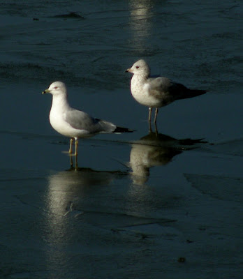
This final part of our walk retraced the path we had used on the way in but the views were different.
When we got back to the dam the Ring-billed Gulls were still gathered on the ice near the dam. We sat on the top of the dam watching them for some time. The ice in the foreground at the lake shore was still a couple of inches thick.
The exposed beach is quite wide on this section of the lake.
The trail – almost back to the campground.
The dock at the north end of the campground.
A closer view. This view is quite impressive.
The yurts, again - but from a different angle.
And a closer view – with a reflection on the calm waters in the late afternoon.
Click on an image to view a larger image
Related posts:
- Marburg Creek Reservoir: Fort Yargo State Park
- Campground - Dam Loop: To The Dam
- Campground - Dam Loop: Dam To The Half-way Point
- Campground - Dam Loop: Half-way Point Back To The Dam
- Zen: A Spiral Of Gulls
- Ring-billed Gulls (Larus delawarensis)
Sunday, January 31, 2010
Saturday, January 30, 2010
Campground - Dam Loop: Half-way Point Back To The Dam
The trail follows the shoreline until it has to ‘detour’ around a small canyon that ends in an inlet on the lake. It climbs the hill through the woods and then forks. The trail to the left is a ‘shortcut’ back to the dam. We took the trail to the right.
The trail emerges into a grassy area. Even though the temperature was in the low 60s F, there was still snow on the path.
The trail then entered woods again. These were younger woods and it felt like walking through a bower.
The trail widened. Although still wooded, this trail was open to the sky.
This Common Mullein (Verbascum thapsus) was healthy but didn’t look too happy after the recent freezing spell.
Another evidence of Elephant’s Foot, probably Elephantopus tomentosus
As we arrived back at the dam, another cyclist was heading up the trail we had just come down.
Click on an image to view a larger image
Related posts:
- Marburg Creek Reservoir: Fort Yargo State Park
- Campground - Dam Loop: To The Dam
- Campground - Dam Loop: Dam To The Half-way Point
Friday, January 29, 2010
Campground - Dam Loop: Dam To The Half-way Point
At the west end of the dam, we followed the trail north and then west and southwest along the shoreline.
Almost immediately on the right is a tree with the largest gall I have ever seen. It must have started when the tree was small and has grown with it.
The trail follows the shoreline offering vistas of the lake.
The trail turns west and winds gently along the lakeshore. It's a pretty trail and fun to walk.
The dock by the beach and Picnic Area #1 is high and dry.
A closer view of the dock.
Fish attractors at the east end of Picnic Area #2 have been exposed.
Click on an image to view a larger image
Related posts:
- Marburg Creek Reservoir: Fort Yargo State Park
- Campground - Dam Loop: To The Dam
Tuesday, January 26, 2010
Campground - Dam Loop: To The Dam
I wanted to explore some more trails around the lake. We decided to walk from the parking lot by the Walk-in Campground where the yurts are located, south, across the dam, loop through the woods and back.
As we drove down towards the lake, it was apparent that something was ‘wrong.’ On the other side of the lake, I could see a brown band at the shoreline. It didn’t make any sense since the lake level was at full pool a week or so previously. It took a minute to convince myself that the lake level was actually low. And just when I was getting enthusiastic about getting out and rowing again.
The route.
The trail follows the east shore of the lake south to the dam (Segment 6).
The low lake level left some tree stumps exposed. This one was particularly photogenic. Modern art.
At the end of the woods, looking south towards the east end of the dam.
A field opens off to the east. One of the cattail beds is on the right.
The cattails have gone to seed.
Water was being released from the lake as we walked across the dam. The measure on the side of the overflow tower indicated that the water level had been lowered five to six feet. One of the flocks of Ring-billed Gulls congregates in the background.
It was a pleasantly warm afternoon in the sun. The weather had brought out a number of cyclists; this one was riding up the hill below the dam.
Click on an image to view a larger image
Related posts:
- Marburg Creek Reservoir: Fort Yargo State Park
- Zen: A Spiral Of Gulls
- Ring-billed Gulls (Larus delawarensis)
Thursday, January 21, 2010
Ring-billed Gulls (Larus delawarensis)
Although some of the gulls floated in a spiral across the lake, most congregated in a couple of tight groups. One group had gathered on the ice that had formed at the dam during the long, cold spell. The ice was melting but there was still a thin layer that was either ‘dry’ or covered with a layer of water. We sat on the top of the dam and watched them for a long time.
They would stand together and were skittish so we couldn’t get too close. Occasionally a few would take off, fly in a wide arc over this end of the lake and land again.
Some flapped their wings.
Others – juveniles and adults - just stood around enjoying the sun.
Click on an image to view a larger image
Identification resources:
- Sibley, AD. 2000. National Audobon Society The Sibley Guide to Birds. p. 214. Alfred A Knopf, New York. ISBN 0-679-45122-6
- The Cornell Institute of Ornithology - All About Birds: Ring-billed Gull (Larus delawarensis)
Related posts:
- Marburg Creek Reservoir: Fort Yargo State Park
- Zen: A Spiral Of Gulls
They would stand together and were skittish so we couldn’t get too close. Occasionally a few would take off, fly in a wide arc over this end of the lake and land again.
Some flapped their wings.
Others – juveniles and adults - just stood around enjoying the sun.
Click on an image to view a larger image
Identification resources:
- Sibley, AD. 2000. National Audobon Society The Sibley Guide to Birds. p. 214. Alfred A Knopf, New York. ISBN 0-679-45122-6
- The Cornell Institute of Ornithology - All About Birds: Ring-billed Gull (Larus delawarensis)
Related posts:
- Marburg Creek Reservoir: Fort Yargo State Park
- Zen: A Spiral Of Gulls
Tuesday, January 19, 2010
Zen: A Spiral Of Gulls
The arrival of gulls at Fort Yargo State Park is a sure sign for some of us that winter is here. The gulls usually flock together in tight groups. Last week, we noticed that a large group of them had drifted out in a spiral. As time passed the spiral gradually opened up and the gulls dispersed until none were left. It was fascinating to watch.
Click on an image to view a larger image
Labels:
Barrow County,
Bird,
Fort Yargo State Park,
Georgia,
Gulls,
Marburg Creek Reservoir,
Winder
Sunday, January 17, 2010
Walk To The Old Fort: Part 4. Fishing Area – Picnic Area
The first part of the walk from the Fishing Area back to Picnic Area #1 was along the trail I had used on the way up.
A couple of fisherman were enjoying an afternoon on the lake. I’ve never seen fishermen catch much. They must catch something or they probably wouldn’t keep coming out to the lake. I think they secretly just enjoy being out enjoying the sun and fresh air.
I found an interesting mushroom. It’s a tooth fungus. I think it’s a Sweet Tooth (Hydnum [Dentinum] repandum). I also found one small patch of Cranefly Orchid leaves soon after leaving the Fishing Area but I think this southern section is too sunny and dry for them to flourish. I came back down to the bridge that crosses an inlet along this section of the lake. Rather than go all the way back to the Picnic Area #1 on the trail I used earlier, I spotted signs for the Disc Golf course. I thought I could get on to the course and make my way back to the parking lot. I might have been more successful if I’d had a map of the golf course.
Disk golf is played with a Frisbee. The course is set out through the woods with a ‘T’ area and an open ‘fairway’ that follows a path through the woods – or is it the other way around. A sign for each ‘hole’ shows the map for the hole including the distance and par (number of tosses). This is a popular sport. I encountered four people playing - on a winter day mid-week – while I was there. One group had dog with them; not sure if she retrieved Frisbees or just enjoyed the walk.
I walked the trail for one hole up the hill only to find that I really couldn’t see a hole that would lead me back to the picnic area. I did, however, have a nice view of the lake through the trees.
The basket at the end of the 16th hole.
I dropped back down on another fairway to the bridge. Over the bridge and along a different trail to the Picnic Area. Fin
Click on an image to view a larger image
Identification resources:
- Mushroom: Sweet Tooth (Hydnym [Dentinum] repandum)
Related posts:
- Marburg Creek Reservoir: Fort Yargo State Park
- Walk To The Old Fort: Picnic Area – Fishing Area
- Picnic Area – Old Fort: Part 2. Fishing Area – Old Fort
- Picnic Area – Old Fort: Part 3. Old Fort - Fishing Area
Saturday, January 16, 2010
Walk To The Old Fort: Part 3. Old Fort - Fishing Area
The Old Fort. The trail entered the clearing from the woods to the left of the fort.
I stopped by the Old Fort yesterday to get a photo and remembered why I didn’t have a good one. The fort now sits against the wood at the south side of the clearing. It‘s in the shade of the woods most of the time. Yesterday, someone had lit a fire to heat and dry the interior of the fort.
I turned around at the edge of the woods and started back towards the Fishing Area. The path is relatively wide and well-worn and easy going.
I found a Southern Grapefern (Botrychium biternatum) – just one plant – just off north side of the path.
And then I spotted Cranefly Orchid (Tipularia discolor) leaves.I was really interested in seeing if I could find Cranefly Orchid leaves. This area would get its best light in the morning but is heavily wooded and would stay moister and more shaded in the summer than other areas in the park. Once I found this patch, I began to see them everywhere along the west side of this path. There were few on the eastern slope below the path.
Most of the leaves were among the fallen leaves but I found one small patch of Cranefly Orchid leaves at the base of a tree. This will be a pretty location when they bloom.
The trail continued to wind its way gently though the woods.
Until I was back at the Fishing Area bridge. To be continued…
Click on an image to view a larger image.
Resources:
- Southern (Sparselobe) Grapefern (Botrychium biternatum)
- Cranefly Orchid (Tipularia discolor)
Related post:
- Marburg Creek Reservoir: Fort Yargo State Park
Friday, January 15, 2010
Walk To The Old Fort: Part 2. Fishing Area – Old Fort
From the Fishing Area, I set off along the lakeshore using the trail well-walked by fishermen. I walked the first part of this section many times looking at Amanita sp. last Fall.
Most of this section is a narrow, rough trail with many exposed tree roots and boulders but it's still my favorite part of the trail. It’s a hazardous section that’s used by the mountain cyclists when they want a thrill. The sign at the other end of this section has named it the ‘Rock Garden.’ (Interestingly, I’ve seen cyclists 'stall out' on the Rock Garden but never fall).
The path is directly opposite the Group Camp. These are a few of the sleeping cabins and meeting teepees.
Then I was on to trail that I had never walked. The trail curved a little uphill and away from the lake – actually just taking a shortcut from Section 12 towards Section 11.
The Rock Garden trail joins the main trail – called the ‘Bypass’ as it parallels the Rock Garden trail – which is much wider. The trail then winds its way gently to the open area where the Old Fort is now located.
The trail - a well-worn cyclists path - continues across the field to the road on the other side. I turned around at the edge of the woods. The Old Fort, which sits up the slope to the left of the trail, was relocated from its original site on the south side of the park to this current location several years ago. (There is a photo of the Old Fort on the Fort Yargo State Park website; click Photo Gallery). To be continued…
Note: Fort Yargo SP is a popular park for cyclists. The park is ‘home’ to YABA – the Yargo Area Biking Association - and is the site for several mountain bike events each year. A detailed map of the trails is posted on the YABA website.
Click on an image to view a larger image
Resources:
- Fort Yargo State Park (Click on Photo Gallery)
- Yargo Area Biking Association: Trail map
Related posts:
- Marburg Creek Reservoir: Fort Yargo State Park
- A Little Rain … Then Mushrooms
Subscribe to:
Posts (Atom)